1874 AND 1915-16 TOLL ROADS
Diablo, a Developers Dream or Nightmare
This discussion attempts to focus on the interrelationship between “Diablo, as a Country Club Community” and Mount Diablo itself.
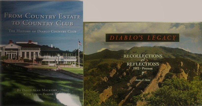
Two excellent cocktail books have been written about Diablo. Both offer historical perspectives and a glimpse of life in this exclusive community. From Country Estate to Country Club – The History of Diablo Country Club by David Alan Mackesey and Diablo’s Legacy: Recollections and Reflections, 1912-Present by James C. Stone.
Neither book focuses attention on the importance of Diablo as a connector to Mount Diablo trails and roads.
The current community of Diablo was the Southern Gateway to the mountain from the mid 1870s first as a working ranch, then a summer resort and eventually as an almost 400-home subdivision.
Early Historical Perspective
The 1872 Yellowstone National Park Act established the first national park and set off a frenzy of land purchases eying tourism.
In 1873 Diablo land was purchased by the big four of railroad fame (Huntington, Stanford, Crocker, and Hopkins). The goal was to monetize the lands spanning some 5,000 – 10,000 acres through any means possible. Ideas included fattening a herd of free ranging burros and planting trees but these absentee owners began to see tourism as a way forward.
All large landowners in the area required the same infrastructure, water for cattle and ranch roads for access to springs on the mountain. Ranch roads were required for cattle grazing and as tourism became a goal, for access to the summit. Raw land is not valuable unless there is water and access.
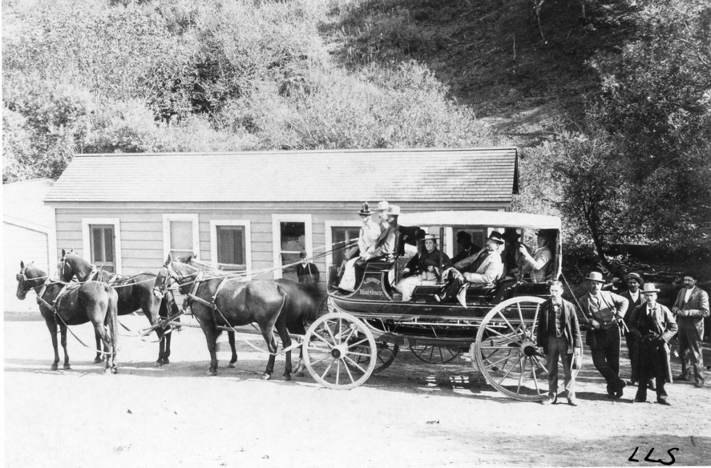
1873-74 Stage Coach Toll Roads Built to the Summit
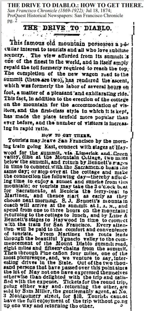
The Green Valley and Mount Diablo Summit Road Company applied for and received easements to build these two Stage Coach Toll Roads, one from Diablo and up through the Rock City area and the other from Walnut Creek through Pine Canon.
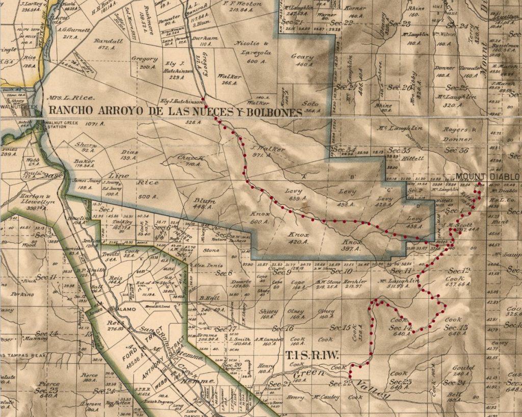
This 1894 map below shows these two stage roads , one from the Green Valley Creek area through what is shown as Cook parcels, up the Section line between Sections 15 and 14, and continuing up through Cook lands to the Summit. The Walnut Creek line follows Pine Canyon and Pine Creek through Walker and Levy and Knox parcels, both roads meeting at the site of the Mountain House Hotel.
These roads were the first step in monetizing the lands surrounding Mount Diablo.
The unsettled nature of early Diablo history is best explained in bullet points:
In 1877 David Colton, the manager of the absentee railroad men’s sprawling lands bought the entire ranch and named it Railroad Ranch. A year later he falls off his horse and dies leaving the estate to his daughter Carrie.
In 1879 Carrie marries Dan Cook and they together improve the ranch and increase landholdings.
In 1882 Dan Cook dies of tuberculosis and the ranch is purchased by his brother Seth Cook and renamed the Cook Ranch.
Seth dies in 1889 of a heart attack and his niece Louise inherits 4,700 acres and along with her husband John F. Boyd changes the name again, this time to Oakwood Park Stock Farm.
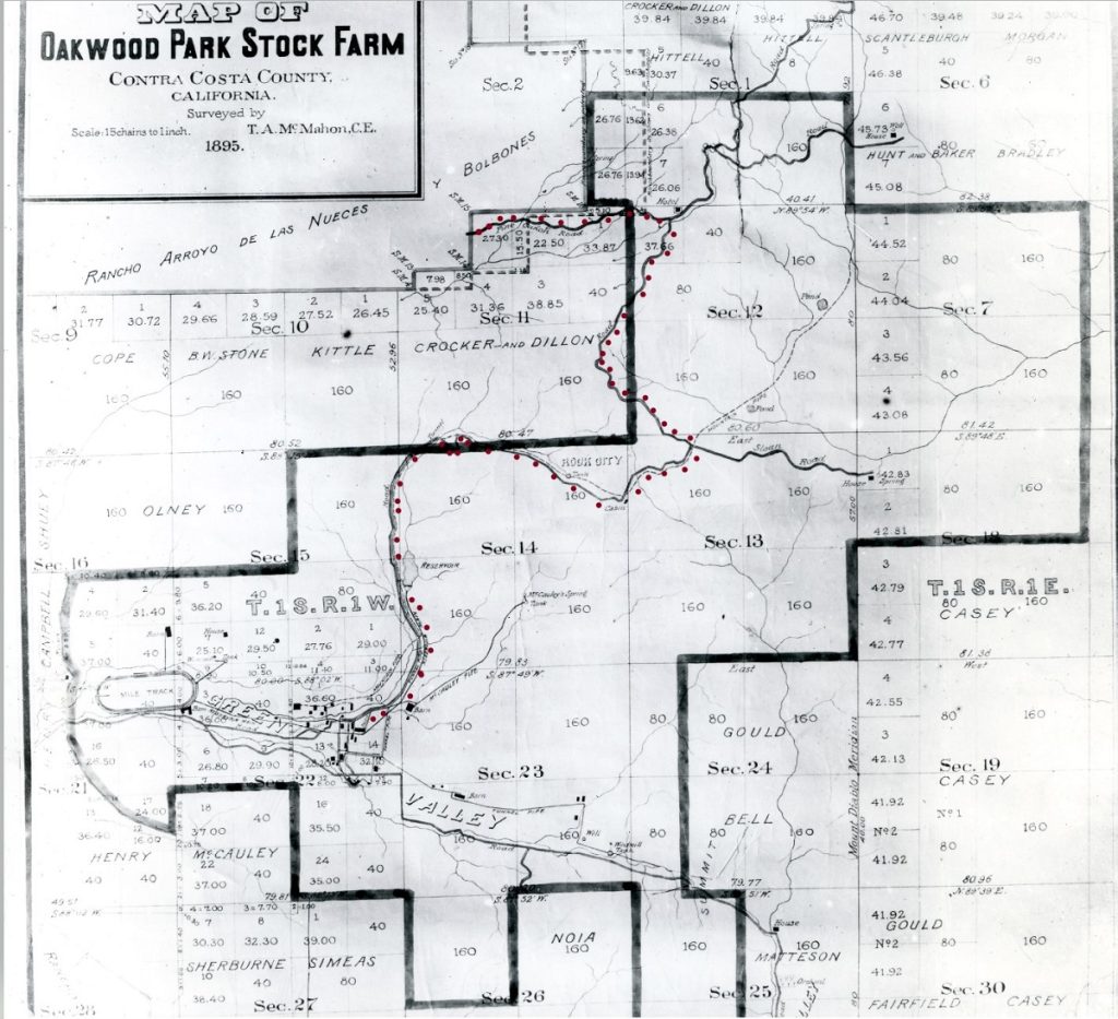
By 1895 this Stock Farm has a number of buildings spread over the Green Valley corridor (black squares in Diablo Country Club area), the Race Track at the far left, the McCauley Spring pipeline bringing water off the mountain, and the Reservoir in addition to the two Stage Coach Toll Roads.
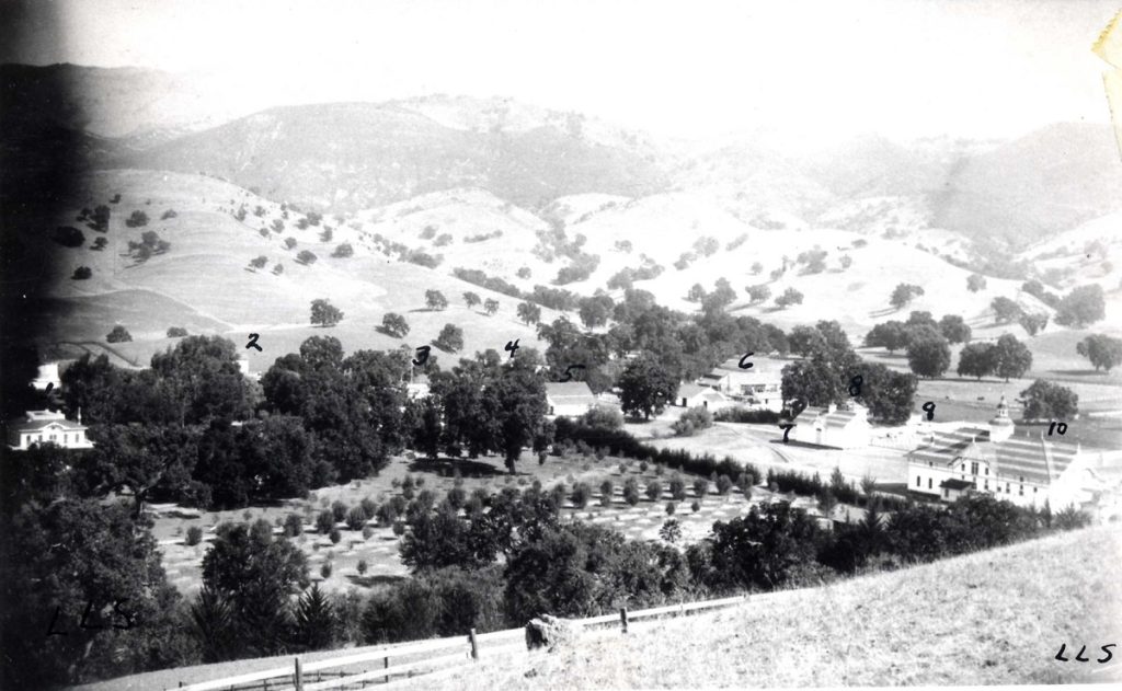
This 1892 Photo from the LLS Stein collection shows various buildings labelled as 1. Boyd Residence, 2. Dairy Barn, 3. Carriage House, 4. Cook house for the ranch, 5. Work horse barn, 6. Shed for implements and stock sheds in rear, 7. Ranch Grainer.
From 1874 until 1912, a full 38 years, very little changed in the Diablo foothills. Parcels changed hands, ranches were expanded and some additional ranch roads were added but the area remained undeveloped as shown in the following 1908 map.
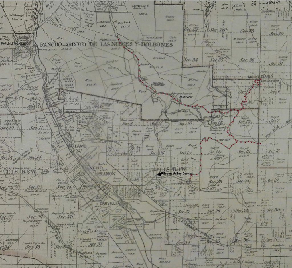
The 1874 Stage Roads are still shown in dark red dots, and labels have been added to show the Green Valley Corner and the Reservoir in Pine Canyon at what we now call Pine Pond. Water and ranch roads were the main infrastructure development in the late 1800s and early 1900s.
In 1911 the Oakland and Antioch railroad added a branch extending to Danville and it was game on for development all around the mountain.
Enter R. N. Burgess a big vision developer.
Burgess purchased Oakwood Park Stock Farm in 1912 with some other real estate friends, Arthur Breed, Harlow Bancroft, and George Emmons. Just like with the original railroad partners back in the 1870s, the discussions turned to monetizing the mountain. Oh, to be land rich and cash poor. How do you create value, a revenue stream from this raw land? After losing money for two years Burgess buys out his partners and begins to act on his vision for the mountain. First to attract visitors using this new machine called an automobile, he needed new roads to the Summit. Well first he needed to own the summit and he purchased more lands in and around the mountain.
But owning more land with limited access was not the answer to profits. So how do you increase visitors?
You promote the heck out of the place and offer convenient points of access. Burgess worked feverishly to attract wealthy San Franciscans, Oaklandians, and knowing that San Francisco was hosting the 1915 San Francisco Exposition (also called the Panama-Pacific International Exposition attracting some 18 million paid admissions) wanted to highlight his mountain and the new summer resort development. He had approximately 196 lots to sell so he built two automobile toll roads to the summit and strong arming a railroad extension from Danville to the center of this new community.
Between purchasing land to the summit and filing a subdivision map for Mount Diablo Estate Park Subdivision First Unit in April 1916, he oversaw the building of Mt. Diablo Scenic Blvd.
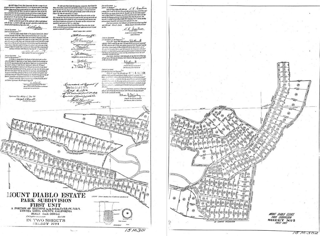
The new toll roads were characterized as controlled grade routes to the summit, as opposed to the more roughly cut 1874 routes that were passable by horse drawn carriage but more difficult for an early automobile. One toll road followed the current Northgate Road route up to the Junction and the other Toll Road began at the center line of Alameda Diablo in the new community of Diablo.
This colored drawing of Diablo Properties proudly displayed at the Country Club and drawn by William Watson in 1920 shows the magnificence of Diablo. The new Toll Road is shown at the far right as the arrow set of switchbacks pointing at the Diablo Lake/Reservoir.
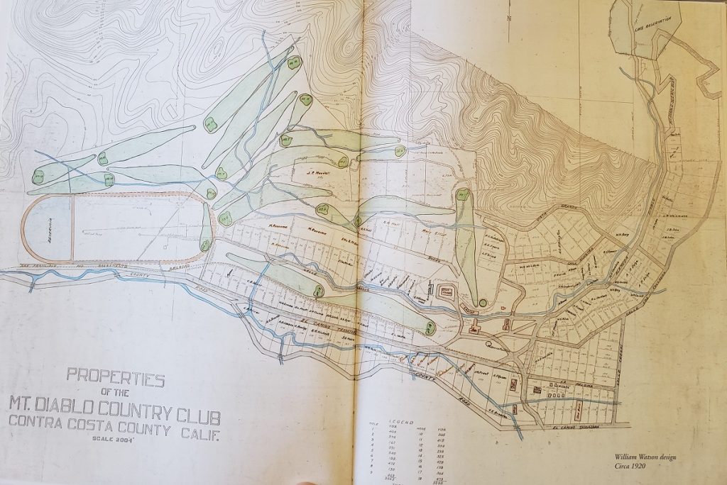
This early Diablo is quite different than today’s Diablo as it shows closer to 200 lots vs around 400 today and many of the streets have been reconfigured and/or changed names. But it does show how the railroad extension from Danville came into Diablo along what is now the Barbara Hale Bike Path from the Green Valley corner and terminated near the Red Horse Taven and Inn. The railroad extension, called the Toonerville Trolley ran for around 10 years, closing for good in 1924.
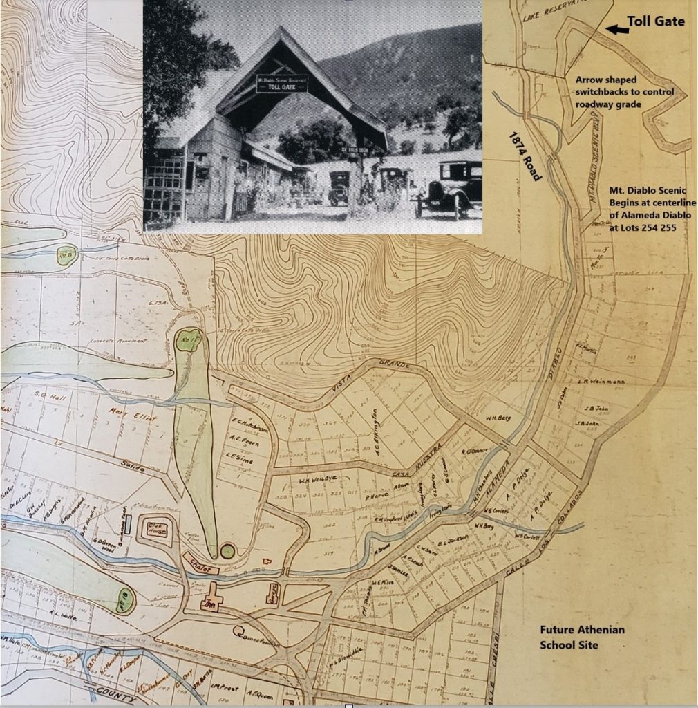
Mt. Diablo Scenic Blvd started at the centerline of Alameda Diablo between Lots 254 and 255 at the far end of the 1916 Subdivision creating Diablo. Lot 255 would eventually be removed completely as the story continues but note two important points. First is the shape of the arrow, so clearly seen in maps of the area. This shape was carved to bypass a steep hill, the curves being required to keep the roadway grade more gradual for automobile traffic. Second, the road itself was just like any other road in and around Diablo until it climbed past the Lake Reservation where the paid portion of the road began. The toll gate inset photo above is from 1920 and clearly shows this is Mt. Diablo Scenic Boulevard Toll Gate.
Every visitor on their way to the Summit of Diablo had to drive through the center of the Diablo Community, up Alameda Diablo, around the arrow to the Toll Gate for Summit access.
Unfortunately economic circumstances including World War 1 destroyed developer dreams and Burgess lost ownership and control of his vast holdings including the Toll Roads and the Diablo properties.
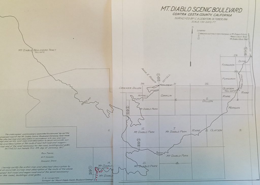
This Map from Contra Costa County Road Book #4 1917 shows the extent of the Toll Roads that were going bankrupt and being taken over as County roads. Mt. Diablo Park lands are shown, those being owned at the time by Burgess and also lost in 1919.
Walter Frick and George NcNear acquired many of the assets at a bankruptcy auction and they renamed the development Mount Diablo Country Club. And away we went with a new set of development partners.
The 1920s were good economically and Diablo Country Club prospered and grew to around 400 members by 1929 according to a Byron Times article. All the while there was serious momentum for Mt. Diablo to become a State Park.
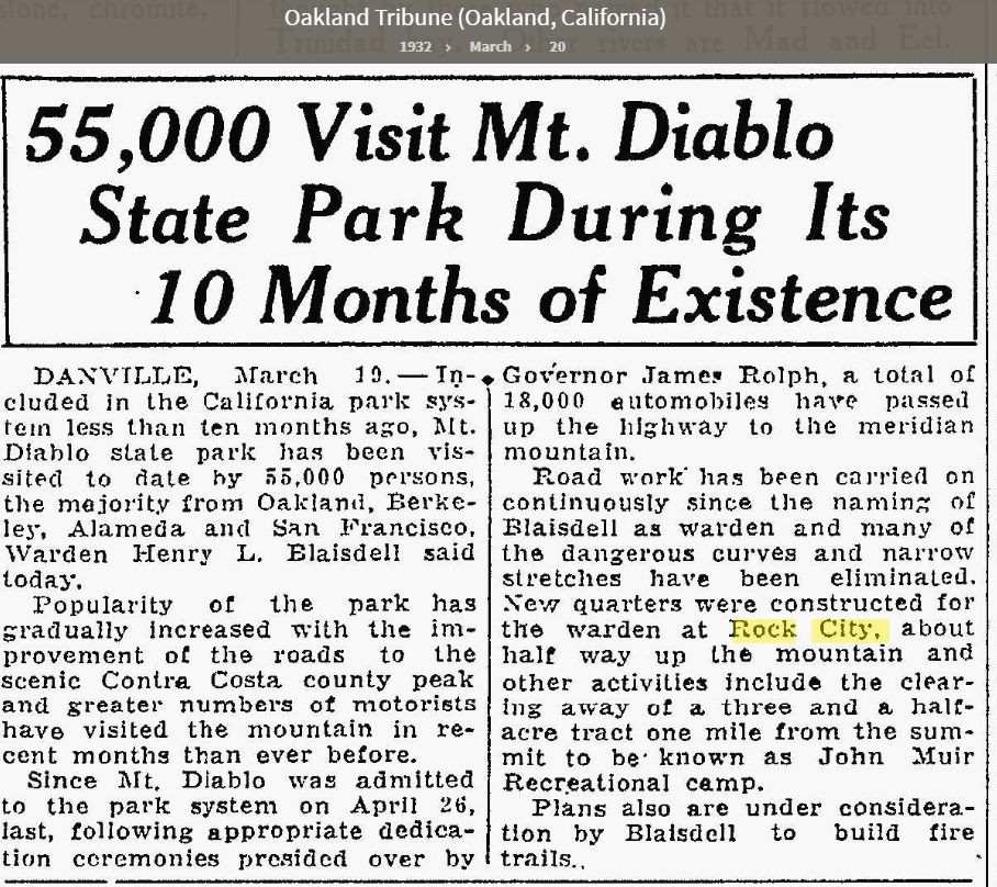
In 1921 Mount Diablo State Park and Game Refuge was created up near the Summit. It was only 630 acres and was formed as a dedication only (dedications related to the State Park system began in 1921).
In 1927 the California State Park System was created, in 1929 the Diablo Property Owners Association was formed and in 1930 a State Park Bond Act was passed providing funds for the official creation of Mt. Diablo State Park in 1931.
Why is this important? Because the Depression would completely destroy developer hopes and dreams and provide a new period of turmoil to Diablo. Frick and McNear essentially lost control of Diablo and new owners Herbert Gray Hills and Herb Hall took over.
Frick subsequently sold most of the initial land for the park to the State in a series of transactions between 1931 and 1936. Meanwhile the community of Diablo recognized that having a State Park in their backyard was a mixed blessing when it came to visitors. Having every Park visitor vehicle drive through the center of Diablo, up Alameda Diablo to Mt. Diablo Scenic Blvd. was a bad idea. Diablo then built another new road on Diablo Land.
This time they took an old ranch road Calle Los Collados and built a new extension road with steep sweeping curves to intersect with the existing Mt. Diablo Scenic Blvd., meeting again at Lot 255 and further making this parcel unviable for resale. New lots would be added within the curve of this new road and Lot 255 would be absorbed into surrounding parcels.
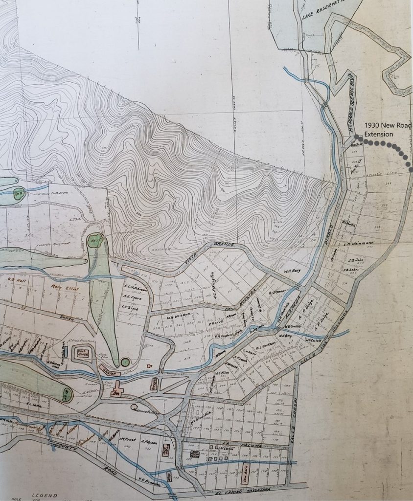
This solution seemed like a good one because it routed Park traffic away from the center of Diablo to peripheral streets instead. Calle Crespi and Calle Los Collados now became Mt. Diablo Scenic Blvd. as the renamed streets offered the Park a new entrance and vehicle traffic was routed onto this new roadway. These were still Diablo streets, just with a new name and a State Park access easement.
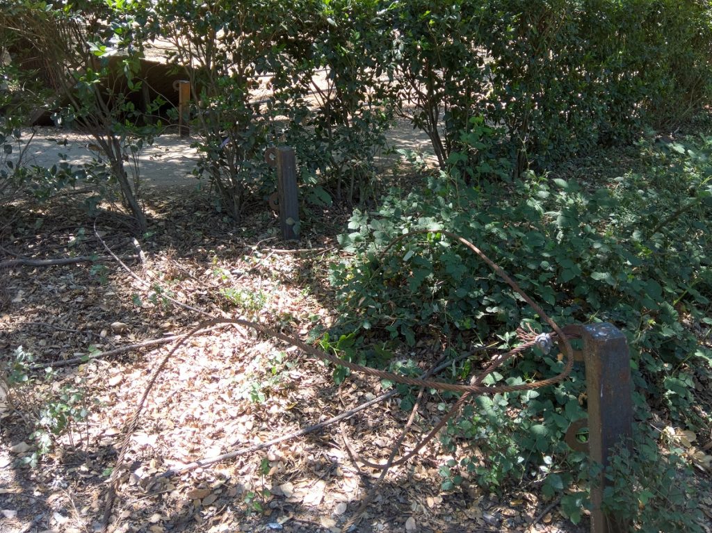
The old Stub roadway, the original first 160 feet of Mt. DIablo Scenic Blvd (a 60 foot wide easement) starting at the centerline of Alameda Diablo was closed to vehicle traffic, marked by 4-inch metal posts set approximately 12 feet apart and strung with a braided wire rope. This exact location and surrounding vacant lands became the preferred connector between the two roadways for pedestrians, equestrians, and cyclists over the next 90 years.
Diablo Surrounded By Grasslands
One final comment is important for historical perspective. In the early 1900s and into and through the 1940s Diablo had very few trees. Diablo was located up against the mountain in and among hilly grasslands. It was not until the 1950s and 1960s that year-round residential development began to landscape the growing community with extensive planted trees.
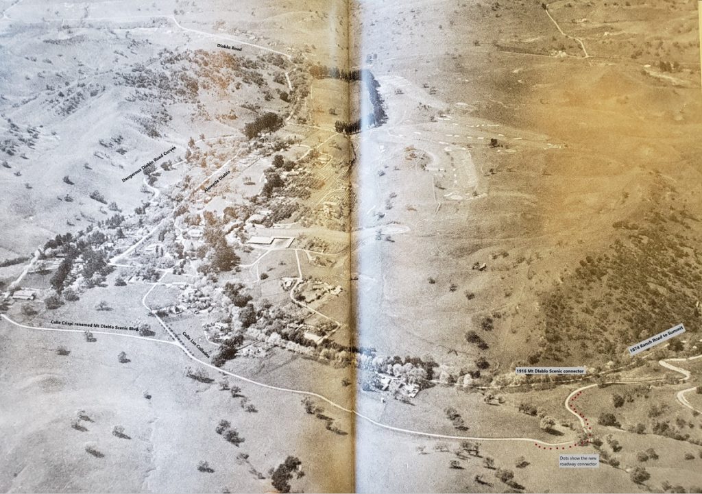
Herb Hills gifted this aerial photo to the Country Club in 1930-1931 at the time that he and Herb Hall took over the club. It also coincided with the opening of the new Mt. Diablo Scenic Blvd extension and the opening of the new Mt. Diablo State Park. I have added labels to this photo because it is so incredibly helpful in understanding what the community looked like at the time the State Park was created.
Those of us who travel through Diablo to access the State Park need to reflect on the truly spiritual connection that early Diablo residents had with the mountain. Anytime they walked outside they were met with the vast expanse of Mt. Diablo. Grasslands met Chaparral met the peaks and the sunsets.
Here too is another cool perspective on the same photo shown above.
This photo uses Google Earth 1939 historical imagery to try and recreate the Herb Hills photo.
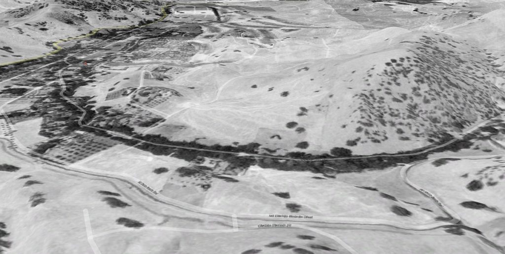
Clearly by 1939 more trees are growing along the main creek and drainage through the center of Diablo but the grassland and personal connection to the mountain still exists.
Little did we know that back in April 1931 the stage was being set for 90 years of struggles related to Mt. Diablo Scenic Blvd.
Easement or Fee Title Ownership Decision
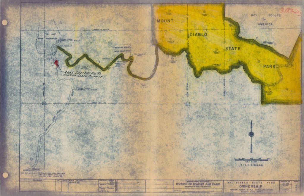
When the Diablo Property Owners decided to offer a new route to the newly formed Mount Diablo State Park, they decided to offer the land as an easement, thereby retaining the roadway land itself as part of Diablo property owners.
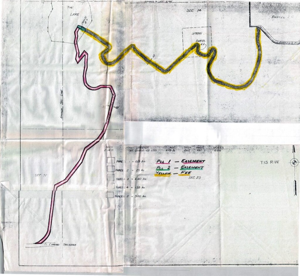
Parcel 1 is shown in Red highlight and that section extends from what we now call the Athenian Corner, where Blackhawk Road, Diablo Road and Mt. Diablo Scenic Blvd all connect and extending all the way up to close to the tip of the arrow (the old Calle Crispi and Calle Los Collados plus the new extension.)
Parcel 2, shown in green extended a very short distance across what was known as the Lake Reservation.
Parcel 3, highlighted in yellow shows “fee title” ownership by the State. Mind you, the State only owned the road and a 60-foot wide right of way but the land on either side of the road was still private even along the yellow highlighted areas.
This seemingly fine point of Diablo maintaining ownership of the road up to the arrow will devolve into lawsuits and recriminations and maintenance frustrations related to that difficult stretch of roadway.
Diablo as a summer resort struggled through the 1930s and 1940s as the depression led into World War II. The golf course went to seed, the public spaces at the country club were taken over by the Navy, roads suffered, the private water system degraded and many homes were all but abandoned. Membership at the club dropped as Diablo succumbed to the realities of economic hard times.
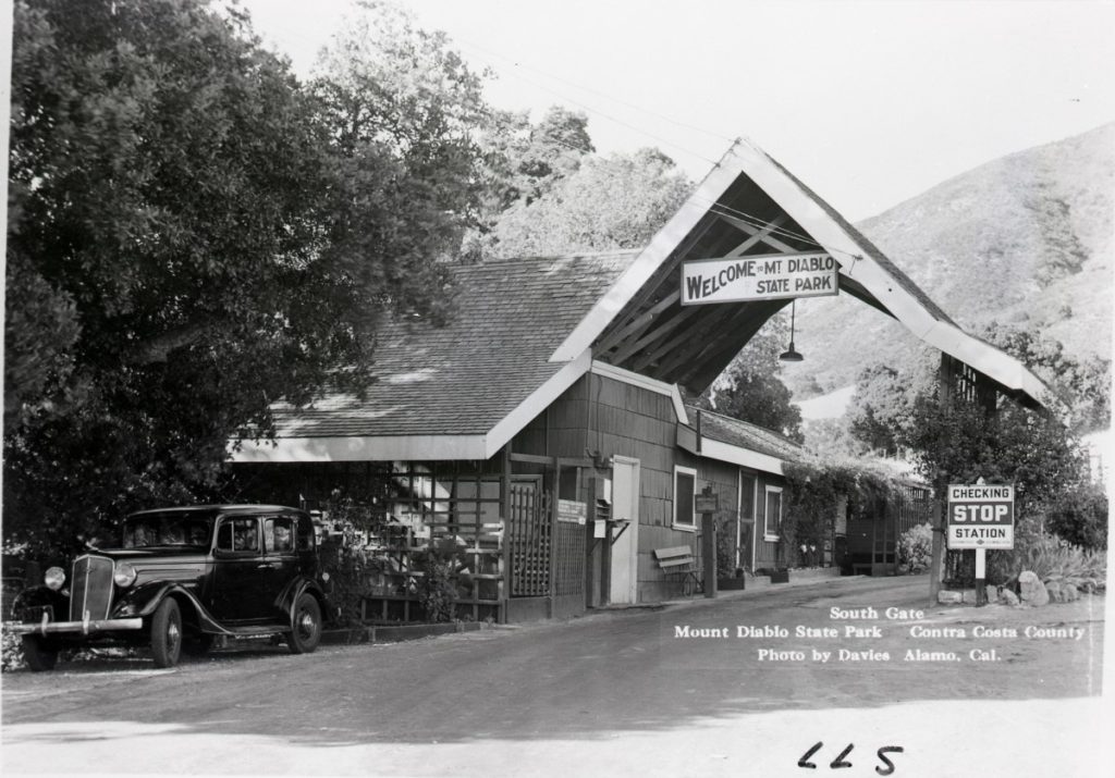
The once promising community struggled through the 1940s as a limited summer resort community.
Then in 1948 new blood, new money, and new ideas gave new life to Diablo. Rapid change was afoot, building into the 1950s and leading to the new chapter the 1960s, growth and control discussion.
Board Of Supervisors Toll Roads
1936 Revision of Mount Diablo Company Purchases (Frick)