DIABLO EQUESTRIAN HISTORY
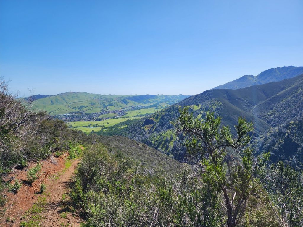
Equestrian Early Days in Mount Diablo State Park
Mount Diablo State Park was created in 1931 at just over 2,000 acres. It had no staging areas, and two public paved roads for access, one from Walnut Creek called Northgate Road and the other from Danville/Diablo called Southgate Road. Still, in its first 10 months of existence, the Oakland Tribune reported 55,000 park visitors. By the mid-1950s annual park attendance had swelled to around 135,000.
The popularity of the park was driven mainly by visitors in automobiles because the park itself was small and somewhat isolated from population centers. Hikers or explorers had to drive up to the area we call the Junction or to Rock City to access the actual State Park. There they could explore Rock City and the Summit, hike on trails and even camp at multiple campsites.
But official park attendance never fully accounted for equestrian visitors because horses could access the park by riding over old ranch roads, often across private lands, avoiding autos and paved roads.
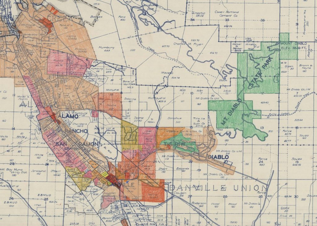
Consider for a moment that in 1940 Contra Costa County had a total population of 100,000 quadrupling to 409,000 in 1960.
A 1965 Oakland Tribune article entitled The Horse-Of-Course stated that Contra Costa County and Alameda County combined had a horse population of 25,000 and that Central Contra Costa County had the third highest number of riding horses per square mile in the US. This equestrian lifestyle was driven by access to vast open spaces, by easy access to stables, and an estimated 21 local equestrian clubs or organizations.
A 1985 Sunset magazine article states:

Credit for Trails
Any discussion of Mount Diablo trails and trail advocacy should really concentrate on three factors or groups:
The State Park Planning process and expansion efforts.
The importance of Diablo first as a private ranch, then as an early housing development, and always as the Southern gateway to Mount Diablo.
The importance of and contribution from the Concord Mt. Diablo Trail Ride Association (CMDTRA).
Concord Mt. Diablo Trail Ride Association (CMDTRA)
Let’s start with CMDTRA. In the early 1940s, a group of equestrians recognized that Mount Diablo was an ideal location to hold a competitive long-distance trail ride. After pitching their idea to the Concord Chamber of Commerce, the first 2-day trail ride was held in 1941 with 18 riders. The event was a hit and ridership grew each year, special events were added, and this prompted the establishment of the CMDTRA as an official club in 1945. Like any club, they held pleasure rides and social events and recognized the need for a true property of their own. They purchased 4 acres of land on Bisso Lane (near Buchanan Field) in the late 1940s having no idea how fast this property would become surrounded by development, including freeways.
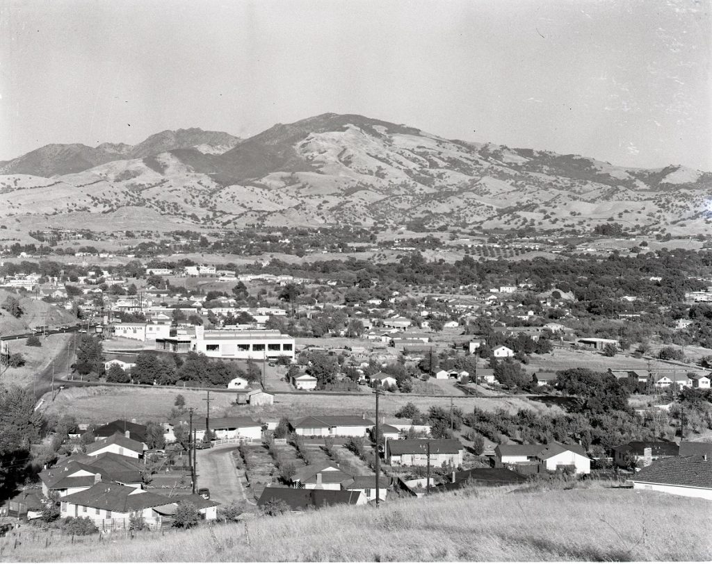
As Contra Costa County grew, the forward-thinking membership traded this land in 1959 (now significantly more valuable) for around 500 acres high up on the Clayton side of Mount Diablo. This was before the State had funding sources so the equestrian organization became its own protector of sorts, eventually selling back 311.88 acres to the State in 1966.
Meanwhile CMDTRA built trails, advocated for new and improved State Park access for all users and enjoyed their own prime park access from the Clayton side of the mountain.
Critical to the organization’s effectiveness was the involvement of George Cardinet Jr. who worked to encourage, establish and advocate for trails throughout the county and state. A CC Times obituary from 2007 summarizes his contributions:
George was an avid horseman and for over 65 years he worked tirelessly as an advocate for the preservation of public open space, the development of parks, and riding and hiking trails. His impact on the development of trails spanned local, regional, state, and national trails. He first became involved in trail advocacy in the early ’40s as a member of the Contra Costa Development Association concerned with the development of recreational open space to support the growing populations associated with the county’s industrial development. His trail development in Contra Costa County served as a model for the California State Riding and Hiking Trail Plan that eventually led to the California Riding and Hiking Trails Act of 1945 and the California Recreational Trails Act of 1974. At the same time, George’s efforts significantly contributed to the National Trails System Act of 1968 which established an extensive system of scenic and historic trails.
George worked with the East Bay Regional Park District to annex portions of Contra Costa County with the park district to establish trail links between east bay regional parks and Mount Diablo State Park. In all, George is credited with having mapped and routed more than 200 miles of trails throughout the greater East Bay region.
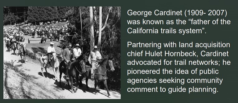
In an Oakland Tribune article from 1972 George is quoted as saying, “We need even more trails not only for horsemen but where terrain permits for hikers and bicyclists as well.” He was clearly an equestrian but first and foremost a trails advocate.
As proof of the importance of CMTTRA and George Cardinet Jr. to trails and Mount Diablo Park access, one need look no further than the 1977 Mount Diablo Interpretative Association (MDIA) Trail Inventory and Evaluation for the State Park – Table of Contents for North Slopes of the mountain.
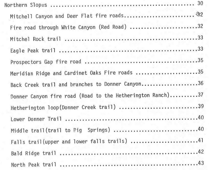
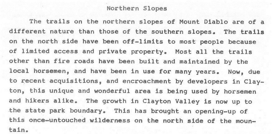
Conducting virtually all of the Northern Slopes trail analysis were George Cardinet and Bob Doyle. (More on Bob Doyle’s early trail advocacy in the Trail History – Diablo and California article.)
The State Park system needed local advocates to raise the awareness of this beautiful park and to lobby for additional park funding. Within the constraints of public funding the park did grow, adding around 5,000 acres during the 1960s and thoughtfully negotiating various easements and fire breaks as park planners protected access and planned for further park expansion.
The State Park public records request process offers the following examples of very early easements (shown below this article).
1934 Easement agreement from Mt. Diablo Company for right of way along Curry Canyon Truck Trail (extending from Curry Point towards Clayton) and for the construction and maintenance of said fire and truck trail.
1934 Easement from Mount Diablo Co. Club for the construction and maintenance of a fire break and truck trail beginning at the Summit of Wall Point and extending to a point on the old road leading from Mount Diablo Country Club.
1935 Easement for construction and maintenance of said fire and truck trail called the Perimeter Truck Trail
1936 Right of Way Permit from Charles Fryer for Pine Canyon Truck Trail and construction and maintenance of said fire and truck trail.
1936 Right of Way Permit for Eagle Peak #1 , a right of way easement for the construction of and maintenance of a foot trail in the Mitchel and Donner Creek area.
These early easements were a critical way to protect access across private property as the new State Park mapped and planned for future acquisitions. Over time more easements were added as the State purchased more lands to add to the park.
Diablo, the Southern Gateway to Mount Diablo
Diablo history and development, starting in the 1870s, provided the first park access via two Stage Coach Toll Roads, one up Pine Canon (map spelling) from Walnut Creek, the other from the center of Diablo out of Danville. In 1873 the big four of railroad fame, Huntington, Stanford, Crocker, and Hopkins acquired thousands of acres of Mt. Diablo and David Colton managed the property and eventually bought it from them in 1877 (renaming it called Railroad Ranch)
We begin the story of roadway access in 1874 as Mount Diablo Interpretive Association (MDIA) summarizes

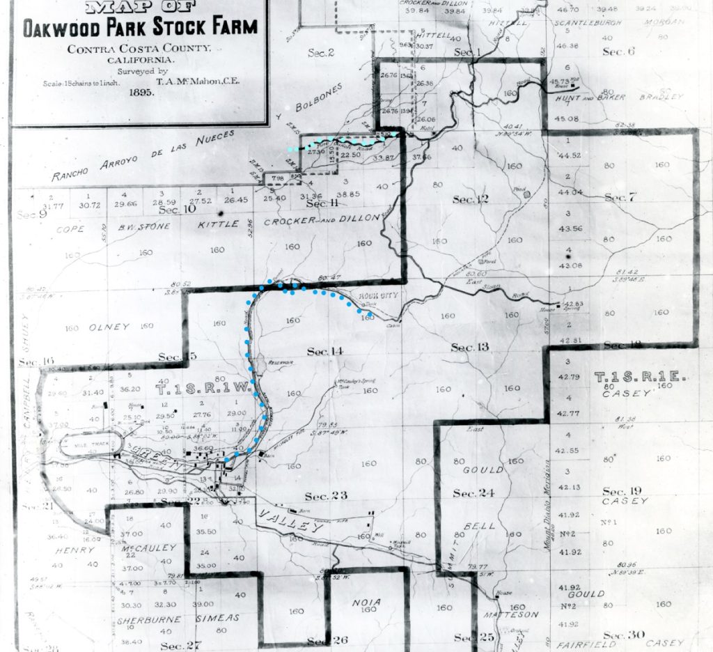
The dark blue line being the old road from Diablo to Dan Cook Canyon and up to Rock City. The light blue line being the upper end of the Pine Canon Stage Road.
Railroad Ranch becomes Oakwood Park Stock Farm
Think about these early days on a stock farm. The entire lifestyle of a stock farm revolves around horses, raising them, racing them, and riding them for transportation and enjoyment. The Oakwood Park Stock Farm buildings themselves were loosely spread along the Green Valley corridor (small black squares on the above map). This low-lying rich land was perfect for agriculture and raising horses, including an oval race track at the left, where St. Timothy’s Episcopal Church on Diablo Road is located today.
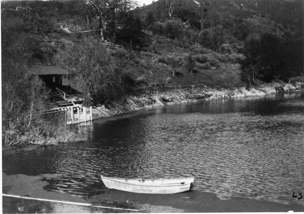
But a stock farm or a working ranch require a source of water and Diablo was rich in springs and deep drainages where water might be captured. Dan Cook actually built the Diablo Lake/Reservoir in 1880 with a 50-foot-high earthen dam and holding enough water to supply the city of San Francisco in 1880 reported the Gazette. The reservoir was 300 feet wide and 700 feet long and would become a source of pride and summer enjoyment for Diablo residents for the next 80 years. The 1874 toll road skirted the left side of the lake (shown clearly in this 1915-16 LL Stein photo).
In 1912 Robert Noble Burgess purchased Oakwood Park Stock Farm and as a developer and wealthy land baron, he began to subdivide this ranch envisioning a world class resort and residential community. His efforts included attracting buyers via an extension of the existing railroad from Danville to Diablo and in 1915-16 he built two new toll roads to the summit. These are the current day Mt. Diablo Scenic Blvd. or often called Southgate and Northgate Roads.
While these two new roads were not a big draw to equestrians, they did remove automobiles from the old 1874 roads and leave them to equestrians and hikers.
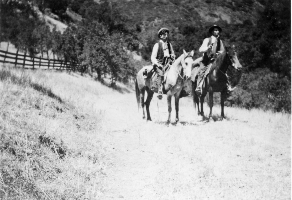
The growing community of Diablo, mostly a summer resort until the 1950s was an equestrian paradise.
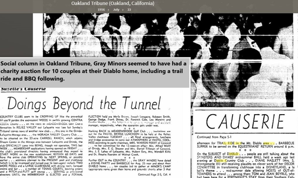
Imagine boarding your horse in Diablo, riding up Alameda Diablo to the private lake resort, then riding past the lake up a beautiful 9%-10% graded road to Dan Cook Canyon and up to Rock City or to the Barbeque Terrace Horse Camp. This route took you up and through what Diablo residents called the upper 160 acres……private undeveloped access into what became the State Park in 1931 via the original 1874 stage road. Early Diablo residents planned BBQs, parties, weekend events, many of which including hiking or riding up to Rock City. The society pages of the local newspapers frequently reported on such events.
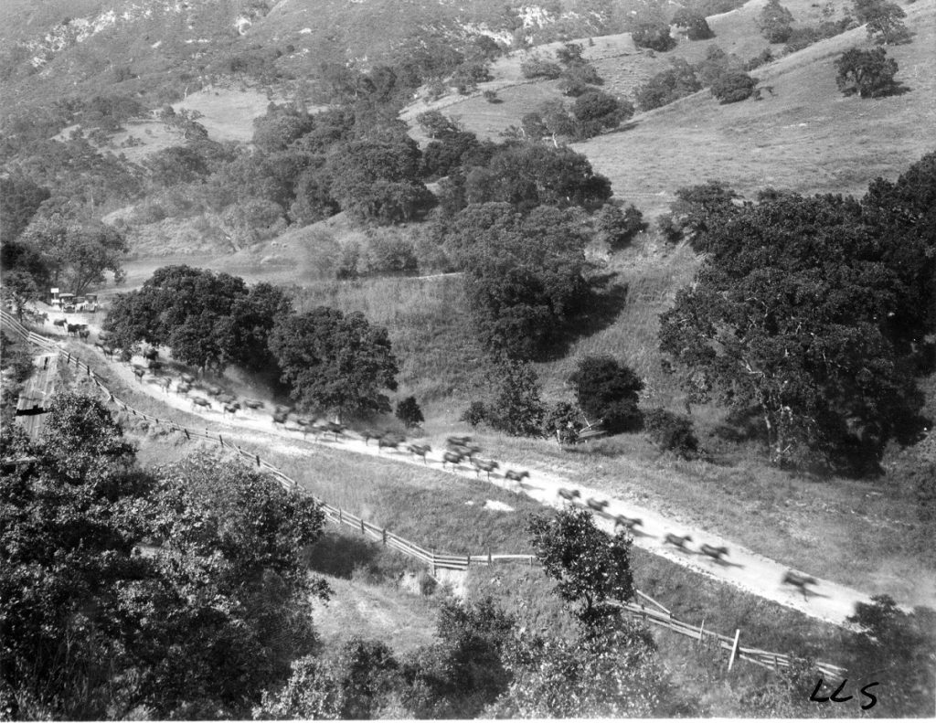
What did the upper 160 acres of Diablo look like back in 1916?
We are fortunate enough to have some early photos acquired by L.L. Stein and maintained by the Contra Costa Historical Society. A favorite photo from this collection is a dramatic shot of a herd of horses being run down the old stage road as the camera looks up towards the Diablo Lake and its earthen dam (grass covered) as it extends towards the mountain. Also note the two automobiles parked at the corner of the dam near a sign.
Equestrians rode up this old road to Dan Cook Canyon through the 1950s at which point it became a pawn in a larger development picture. Over the next 20 years the first half mile of this old toll road would disappear. The Lake would be drained, the dam lowered, leaving only a private seasonal lake for a few homeowners.
While the 1874 stage road had been primarily reserved for Diablo residents and guests it was the most beautiful and most friendly grade for accessing Dan Cook Canyon and Rock City. Unfortunately, this old road was sacrificed, replaced by the building pads of 4-5 homes on 5-acre parcels. The grading took place in the 1960s and the parcels subdivided in the 1970s as part of the Diablo Lakes development.
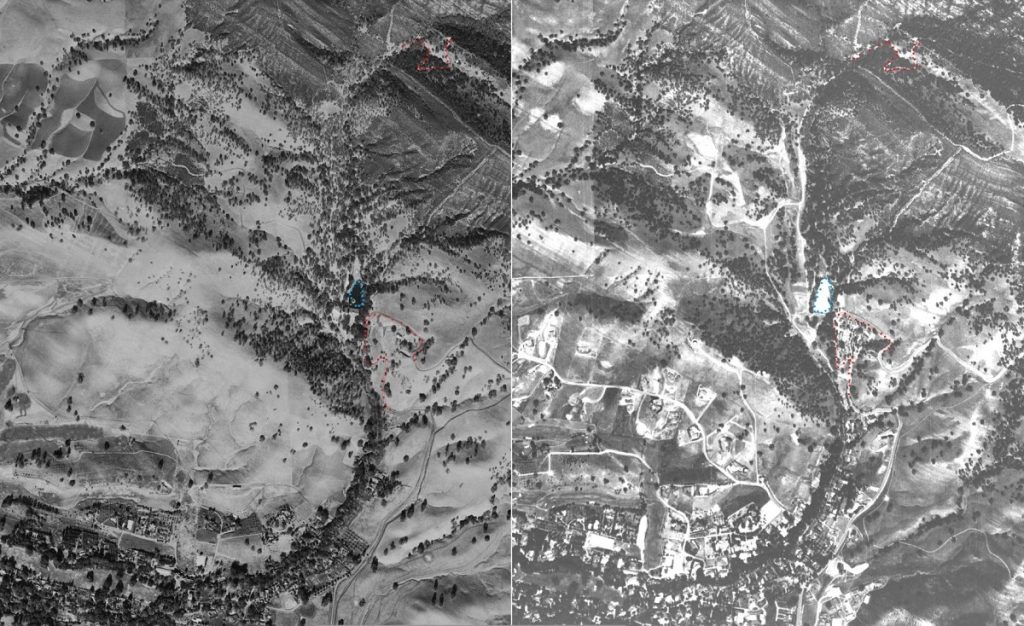
Red dots have been added to highlight the arrow switchback curves of Mt. Diablo Scenic Blvd. just below the blue dots outlining the Lake. Red dots also show the U-shaped switchback section on Dan Cook Canyon on the way up to Rock City.
In the 1960s, the owner of the upper 160 acres of Diablo (which was really 195 acres if one included the Lake Reservation) combined lowering the dam height and rebuilding the spillway with literally wiping away the original 1874 stage road, leaving behind flattened building pads for eventual home sites. This heavy equipment activity required the developers to cut a temporary roadway access to Mt. Diablo Scenic Blvd. raising serious safety concerns. This earthmoving included the cutting of a new access road that would eventually be paved in the 1970s but would have steep sections of a 20% grade.
This development activity severely impacted the equestrian lifestyle of Diablo residents and the stables along Mt. Diablo Scenic Blvd. A new route to Dan Cook Canyon was needed. Fortunately, a Diablo resident and avid equestrian Bill Hale, also an executive of Castle and Cooke, Inc., the owner of the land on the right or Eastern side of the lake, negotiated a new trail easement leading from Mt. Diablo Scenic to Dan Cook Canyon. This easement offered the public a new way to access Dan Cook Canyon without infringing on the now being developed upper 195 acres of Diablo.
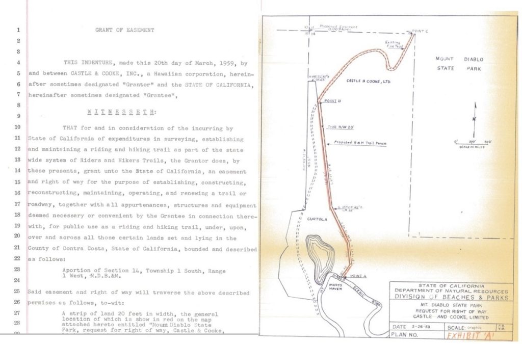
Note the Mary’s Haven label just below the arrow of curves of Mt. Diablo Scenic and Point A showing the location of the old State Park entrance Kiosk. Remember the State only owned the road, most of the land on either side was private until the 1970s and 1980s. Access to the State Park on dirt required accessing Dan Cook Canyon and that required the use of this new trail easement. This easement was a critical connector, and it became popular with all user groups, especially equestrians.
Diablo equestrians would ride their horses up through Diablo streets and ride across the vacant land below the earthen dam to access this new easement that today we call Lower Bridge Loop Trail.
Leslie Foreman lives in Diablo along Mt. Diablo Scenic having bought her property in 1970 or 1971. She and her friends have ridden extensively in the Diablo hills for over 50 years. She and her husband boarded their horse at Haywood’s Southgate Farms along Mt. Diablo Scenic Blvd before purchasing their Diablo property.
Leslie’s parents had moved to California from Ohio in the late 1960s and they rented a cabin from Mary Silva at Mary’s Haven. Mary had purchased her property around 1950 and built a number of cabins directly across from the State Park entrance. One was called the Tea Room and Mary, being an energetic local businesswoman herself, offered her Tea Room as a meeting place for local clubs and organizations.
Leslie says that equestrians did not like to ride along Mt. Diablo Scenic, especially at the dangerous set of narrow switchbacks forming the arrow and now called the Danger Zone. Cars are unpredictable and the narrow pavement and lack of shoulders were a dangerous combination. She carefully rode along Mt. Diablo Scenic from her house to the vacant flat connector below the dam and then across that property on a diagonal up to the dam and to this new 1959 Lower Bridge Loop Trail, avoiding the arrow-shaped curves leading to the park entrance.
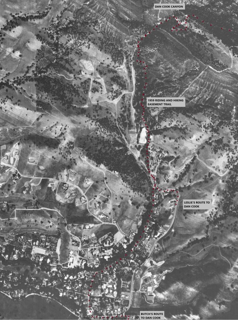
Butch Scott and his wife are equestrians currently living in Alamo on a horse property. In the 1950s and 1960s Butch’s dad owned around 6 acres on the Southern side of what we call the Athenian Corner today (where Mt. Diablo Scenic Blvd and Diablo Road and Blackhawk Road intersect.)
Butch was an endurance equestrian in the early 1970s and he would ride from his dad’s property up the mountain around 4 times per week. The San Ramon Valley Horsemen also would begin their endurance rides from his dad’s property and the preferred route was to avoid Mt. Diablo Scenic Blvd and the dangerous narrow blind curves, riding through Diablo to the same vacant property below the dam and across to the 1959 easement now called Lower Bridge Loop to Dan Cook and up to Rock City and beyond.
Butch was particularly concerned about the mixing of cars or trucks and horses as he was hit while on horseback along Diablo Road by a construction vehicle during the 1970s. His preferred route was to ride along Diablo Road past a few houses crossing and entering Avenida Nueva, up Alameda Diablo, and crossing below the dam to the easement trail the same as Leslie. Today it is hard to imagine horses riding along Diablo streets but until the 1980s, this was a regular occurrence.
In the 1977 MDIA State Park trail survey the following was said about the 1959 easement route:
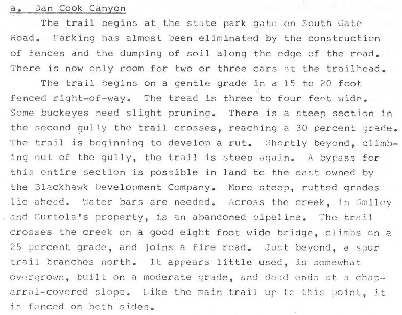
Yes, the reality of this trail is a series of rutted 25%-30% grade sections that can be fun and challenging in perfect trail conditions but poor choices for a sustainable multi-use trail.
This paragraph talks about the Curtola property with the abandoned pipeline which is referencing the fact that the Curtola Water Company was the provider of water to Diablo for many years prior to EBMUD hookups in the late 1950s. Note also the comment that a bypass of the entire section is possible to the East. This references the fact that a new route was created in the 1980s when this area became part of the State Park as shown by the map below. The lower bridge loop references the 1959 easement trail (skirting the State Park boundary line) and the upper bridge loop references the better more sustainable new trail paralleling the original.
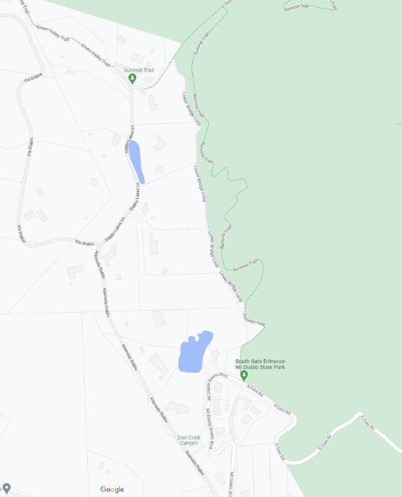
Some suggest that the State built the upper bridge loop (labeled Summit Trail) to offer mountain bikers a separate trail to Dan Cook, others suggest that the State was worried that the original lower Bridge loop encroached on a few of the Diablo parcel property lines and wanted to avoid a confrontation should any single property owner challenge the trail location. In any case, the Upper Bridge Loop to Dan Cook Canyon continuing up the stage road to Rock City has become one of the most popular multi-user single-track trails in all of the State Park. It is an example of good park planning and responsible user sharing of a beautiful trail.
One final nod to equestrians also came during the 1970s development of the Upper 195 acres.
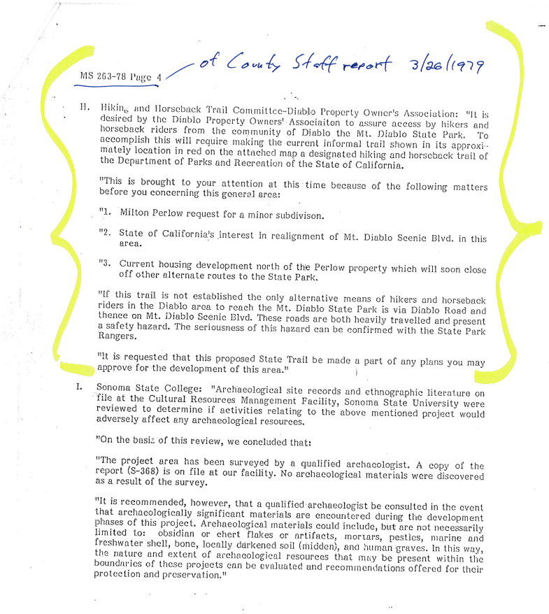
In the late 1970s, the last lot splits in the Diablo Lakes development area (the 195 acres near the lake) threatened to sever the widely used connection between Alameda Diablo and Mt. Diablo Scenic Blvd.
During the shell game of lot splits that occurred over a 4-year time period, County Planners and public users who voiced their opinions, came to two separate but important solutions. The creation of two distinctly different trail easements connecting Alameda Diablo to Mt. Diablo Scenic Blvd.
Kays Trail Began as a Lease Agreement in 1975
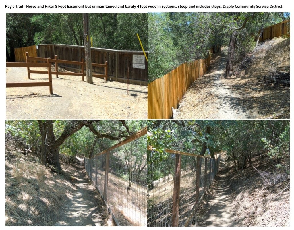
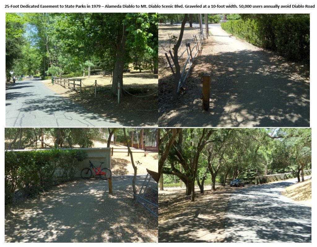
The first trail (now called Kay’s Trail in a nod to a Diablo equestrian) was originally recorded as a 50-year lease agreement between Lawrence Curtola and Robert Smiley, the owners of the undeveloped 195-acre parcel, and the Diablo Community Service District (DCSD). This was first recorded in 1975 as an unmaintained 8-foot-wide horse and hiking trail shown today in the four-part photo montage below. (See Lease Agreement at end of article.)
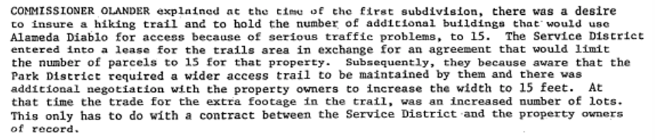
Shortly thereafter, in hearings related to one of the many lot splits there was reference to the fact that the Park District required a wider access trail. Hoping to use this as a solution in August 1977 a new lease was recorded with the County with much the same language and now 15 feet wide. (Lease also at end of article.)
But the equestrian and hiking and biking community were all distrustful of a lease agreement approach. This led to the 1979 Riding and Hiking Easement.
Think about this progression of events. First an 8-foot-wide Lease for hikers and horses, then the Park District saying this was not adequate, so they tried to appease the Park District with 15 feet and quickly recorded this document. That became a dead-end proposal.
1979 Riding and Hiking Easement
Instead of widening this steep hard to maintain trail, in 1979 a separate 25-foot-wide riding and hiking trail was created on the opposite end of this final parcel and overlapping the original 60-foot-wide roadway easement from the starting point of the 1915 Mt. Diablo Scenic Blvd toll road. This 1979 easement was dedicated to the Department of Parks and Recreation of the State of California as recorded on the parcel map creating this last home site. The graphic below shows the two trails in red on a contour map of the area. Prior to this final lot split, equestrians would ride diagonally across this essentially flat lot up to the corner of the arrow, avoiding or minimizing time on Mt. Diablo Scenic Blvd itself.
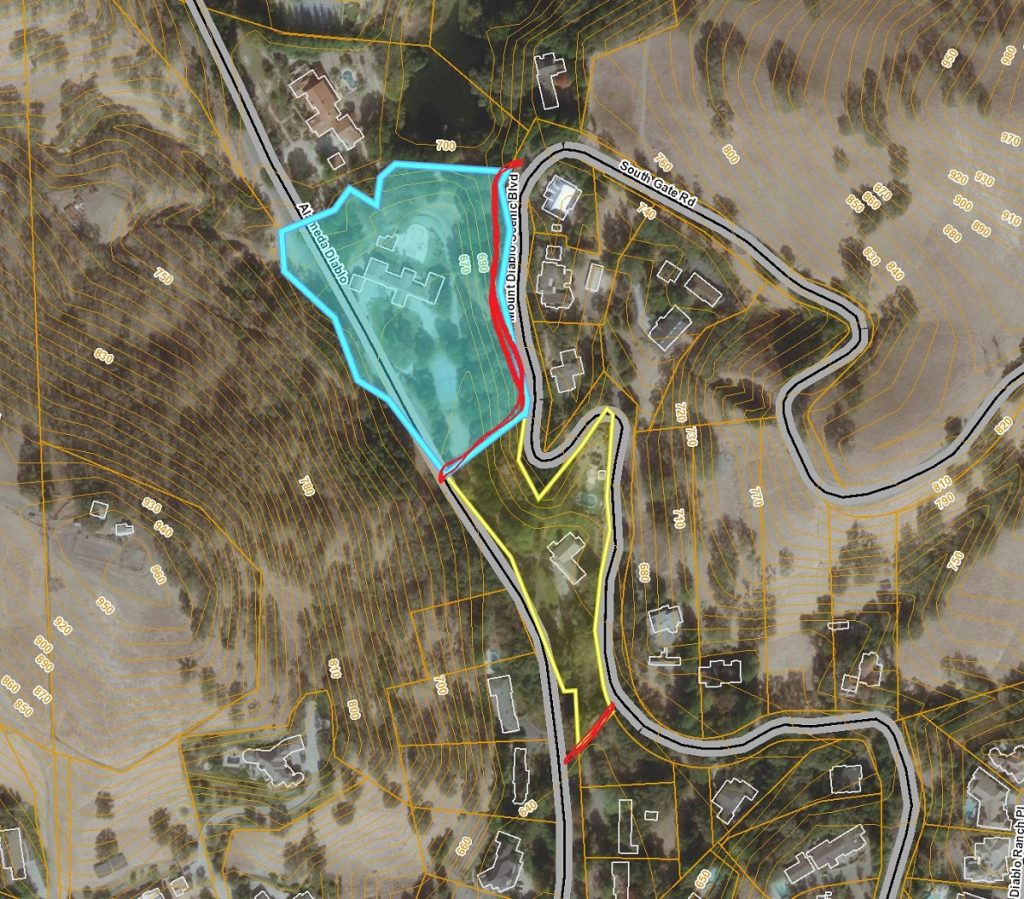
This 1979 25-foot-wide easement is the most widely used connector in the Diablo area mainly because it is short, it is flat, it has good sight lines and it allows hikers, dog walkers, and cyclists to quickly connect to Mt. Diablo Scenic Blvd. from Alameda Diablo. It is even graveled, courtesy of the local cycling community.
As one final nod to equestrians who really did not prefer this new flat connector because it required them to ride though the dangerous arrow curves to the State Park Lower Bridge Loop Trail, the DCSD accepted Kay’s Trail and recorded it as an easement, rather than leaving it as a lease agreement. This happened in 1982 and the agreement is also included at the end of this article.
Equestrians still prefer Kay’s Trail and rarely will a horse be seen using this 1979 connector. Some suggest that during this time period the parks themselves were exploring the concept of separate trails for cyclists and horses, especially as mountain biking as becoming a new sport.
By the 1980s many Diablo horse properties were sold, lots were split, stables were closed and the equestrian way of life in Diablo became a thing of the past. It is now common to see mountain bikes parked in Diablo resident garages.
Back to the Clayton side
Two other easements reflect the proactive nature of the State Park itself in planning and the encouragement from the equestrian community, including the CMTTRA.
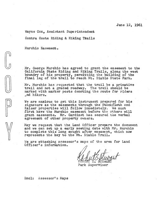
In 1961, a key connection on the Clayton side of Mount Diablo was announced by the State Park supervisor and the Contra Costa Riding and Hiking Trails Superintendent:
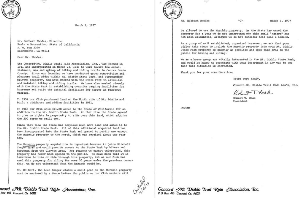
In 1977 another example of the CMTTRA influence on State Park trails and connectivity.
While the story of user access and trail connections in Mount Diablo State Park is an expansive topic, one thing we can be sure of is that the equestrian community really drove the growth of the park and the trail system. Equestrians like mountain bikers cover significantly more ground than hikers and they demand and require longer trail connectors and more remote access.
As the Park grew from 2,000 acres to 5,200 acres in the 1960s, and then to 8,500 acres by 1978, there were still only two paved roads into the park plus semi-private access to dirt trails from the CMDTRA property on the Clayton side, limited access up Pine Canyon and access via Diablo to the bridge loop trails up Dan Cook.
Only in the late 1970s did the State Park add the Mitchell Canyon Staging area with significant help from the CMDTRA and also the Macedo Ranch Staging area off Green Valley Road as additional convenient locations for equestrians with horse trailers, for mountain bikers and hikers. Then in the mid to late 1980s the Green Valley connector was also negotiated as a series of easements to connect Green Valley Road with Mount Diablo through the upper Diablo Lakes area and connect with Dan Cook.
When you see a rider on a horse on the mountain be sure to reflect on how important they as a user group have been to park trails and access.
Links Below:
Concord Mt. Diablo Trail Ride Association (CMDTRA) Website
Bea Frederickson “Pastime” History of CMDTRA from their website (PDF 237 kb)
1959 Castle & Cooke Easement Docs
1975 Lease 8-Foot-Wide Horse and Hiker Trail