1960s – DIABLO GROWTH & CONTROL
In 1948 when Larry Curtola, yet another local developer, purchased Diablo Country Club and surrounding lands and unsold lots, Diablo had less than 50 full time residents. Road and sewers and water and general infrastructure was in poor condition and lots money was needed. The leveraging of public agency funds began.
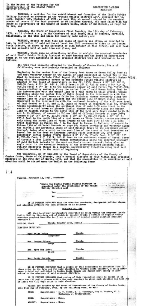
Public funds were initially required to help defray the expenses of infrastructure improvements, so in the 1949 thru 1951 time period Diablo applied with the County to create a Public Utility District. The goal was to access the bond market to begin infrastructure improvements.
Diablo Public Utility District
In March 1951 the Contra Costa County Supervisors voted to approve a Diablo Public Utility District (DPUD) including the specifics of the utility district boundaries.
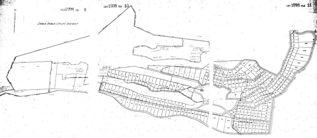
This decision to create a Public Utility District must have been a difficult one as this dramatically reduced the footprint of Diablo but at the same time offered the opportunity to improve the ability of the development to survive. Compare these two maps.
The official County map of Diablo in 1946 shows the following boundaries of Diablo. This is far larger than what was agreed upon in 1951 for the DPUD.
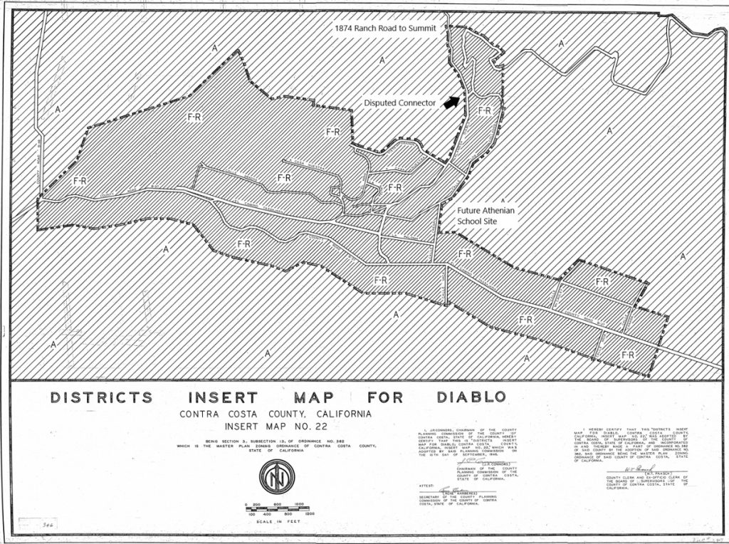
I have labelled the Future Athenian School Site and the 1979 riding and hiking easement (Disputed Connector) and the 1874 Ranch Road to Summit for orientation. Note that Diablo officially extends well into what is now Magee property on the South side of Diablo Road and further note that Diablo extends Eastward well into what is now Blackhawk and other private lands. It also includes the area up to and including land along the arrow.
Transition to a Smaller Community
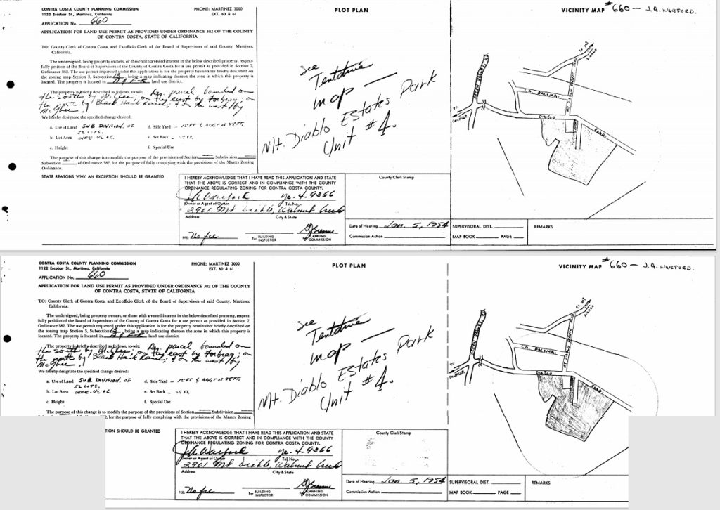
While Diablo was a larger footprint of land, developers continued to try to attach themselves to the Diablo mystique. For example, in 1954 the County was considering the tentative map of a development called Mt. Diablo Estates Park Unit #4 that was situated South of Diablo Road at the Athenian Corner.
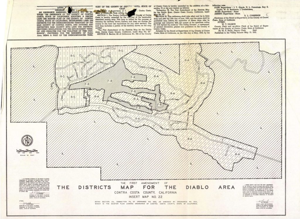
Even the First Amendment of the Districts Map of Diablo published in May 1955 shows the extensive reach of Diablo prior to the redefining of Diablo itself for the utility district purposes.
The decision to restrict the footprint of Diablo may have saved the community but it also set them on a course that could not easily be changed. Problem one solved but other problems created.
Keeping in mind that Diablo had less than 50 full time residences in 1950 and today has close to 400. We need to recognize that Diablo doubled then doubled again and then doubled once more between 1950 and 2023. Each time a lot was split or a minor subdivision added or new roads created, there were County approvals and County records being created.
For example, in the 1950s and 60s Diablo had so many new subdivisions, road changes, and variances requested of the county that the County created a map showing much of this detail, including the street easement widths throughout Diablo.
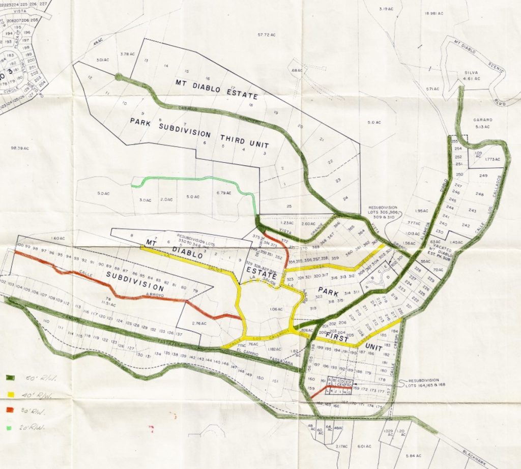
This map is amazing in its detail showing Cameo Acres in the upper left and their 1/2 acre minimum lots. It also shows in green the 50-foot-wide easement widths of the labelled roadways, the 40-foot-wide easement roads and the 30-foot-wide roadway easements alongside two minor subdivisions that were requesting 20-foot-wide widths.
For point of reference we can see Mary Silva’s property shown on the inside of the arrow at the top right. We see the 6.01 acre parcel at the bottom, below Diablo Road and across from the Athenian corner. This property was Jim Scott’s horse property. His son Butch was an endurance equestrian and has stories about riding through Diablo across the 5.71 acre parcel adjacent to the Silva parcel and up across the Diablo Lake dam to Dan Cook Canyon and up the mountain. That 5.71 acre parcel was vacant land until the early 1980s when it was built upon.
Finally, we also see Mount Diablo Estate Park Subdivision Third Unit added in the hilly upper side of Diablo where in previous maps the land seemed too steep for houses.
Back to the Diablo Public Utility District
By 1966 the County delivered the following information to the Diablo movers and shakers……a Utility District has limitations as to its responsibilities and roads become a problem.
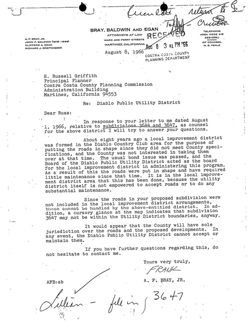
Those Diablo elders put their heads together and had an “Ah Ha” moment. Now that we got what we needed from a Public Utility District (rebuilt roads and sewers) we will now convert this entity to a Community Service District. That way we can tap into public funds into a different way and retain as much control over our streets and lands as possible.
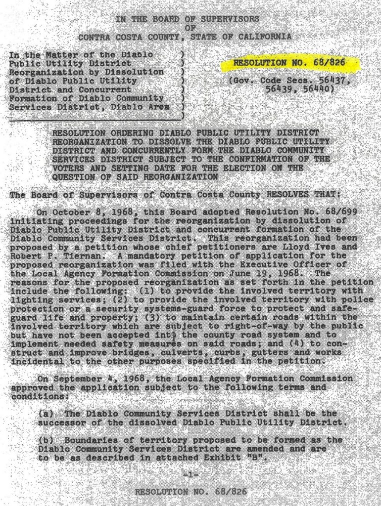
I say this a bit tongue and cheek, but current Contra Costa residents, especially Diablo residents, need to remember that big decisions like these open some doors but shut others. While we can lament what is lost in the way of future flexibility because of such decisions we cannot easily change directions. In 1968 the Contra Costa County Supervisors approved the dissolution of the DPUD and its replacement by the Diablo Community Service District (DCSD).
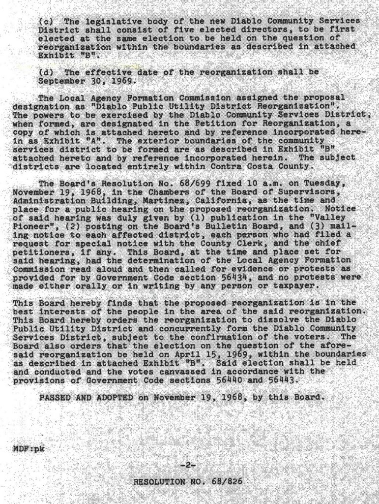
LAFCO took a bit more time to offer their approval as shown by the below certificate.
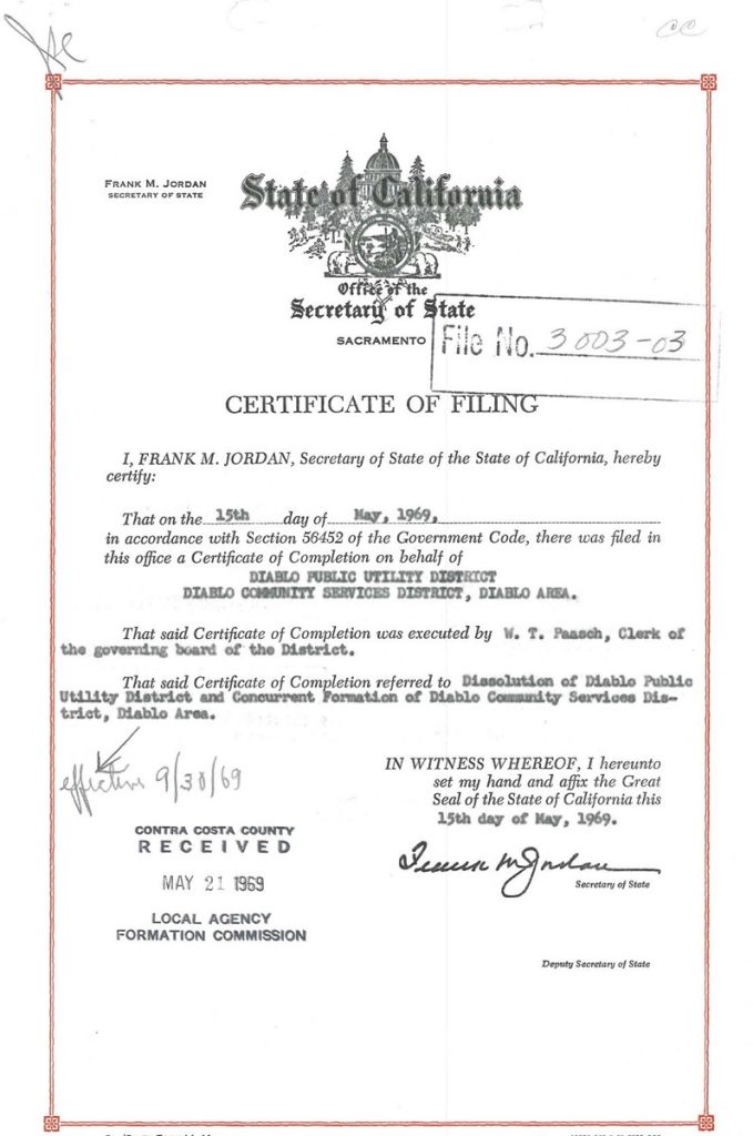
What did all this high-level maneuvering accomplish? By converting to a Community Service District, Diablo retained significant control over their community property. With control comes responsibility. Much like when the previous elders back in 1931 had Diablo retain ownership of Mt. Diablo Scenic Blvd and only offered the State an easement. Such big decisions have consequences for future generations.
Today Diablo has control over the maintenance and repair of their roads and bridges and drainages. They chose that direction for their community. Their roads and bridges are not considered part of the County road system but the County provides the Diablo Community Service District with substantial annual funds for Diablo to spend as they see fit. Why does the County do this? Blackhawk does not get County funds for their roads. Other private developments have to reserve private homeowner funds for their own roads, receiving nothing from the County.
The DCSD agreed to 4 things in their reorganization.
To provide the involved territory with lighting services
To provide the involved territory with police protection or a security systems-guard force to protect and safeguard life and property
To maintain certain roads within the involved territory which are subject to right-of-way by the public but have not been accepted into the county road system
To implement needed safety measures on said roads, and to construct and improve bridges, culverts, curbs, gutters, and works incidental to the other purposes specified in the petition.
That is the extent of the rights and responsibilities as so recorded. (Recorded docs at the end of this article)
Contra Costa Taxpayers Contribute around $100 per month per residence to Diablo
The County provides the DCSD with hundreds of thousands of dollars annually to protect the public’s right to use or pass through Diablo streets, especially to access Mt. Diablo State Park roads and trails. Based on the current number of residences in Diablo each homeowner receives around $100 per month paid to the DCSD for upkeep of this community.
So why did the movers and shakers in Diablo decide upon this direction for their future? I believe it all came down to Athenian school being built and opening in 1965, directly across Mt. Diablo Scenic Blvd.
There is a tendency to think only about your immediate issues and surroundings. Investors call this home bias. Whatever the case, an Agreement For Lease, Purchase, and Sale and Option between Castle & Cooke and Academy (The Athenian School) was dated August 2, 1963. Life in and around Diablo was about to change.
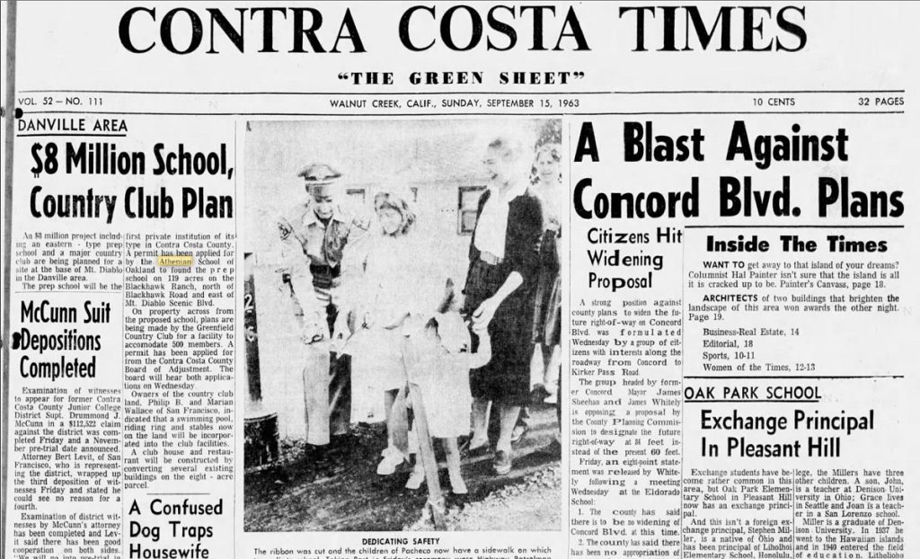
While the September 1963 CC Times article is mainly discussing the new Athenian School, there is a reference to an adjacent property wanting to develop a 500-member country club facility with swimming pool, club house, restaurant, riding facilities, etc. Such a facility would directly compete with Diablo Country Club.
Two more articles related to this proposed Country Club Facility appear in 1962 also in the Times:
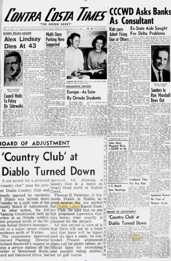
Here we learn that this development is being proposed by none other than Lawrence Curtola and since he owned the Diablo Lakes area of Diablo, also called the upper 160 acres, it would seem to be upon this property that this project was trial ballooned. We will save this entire discussion for the Diablo Lakes 1970s discussion.
Athenian Opens
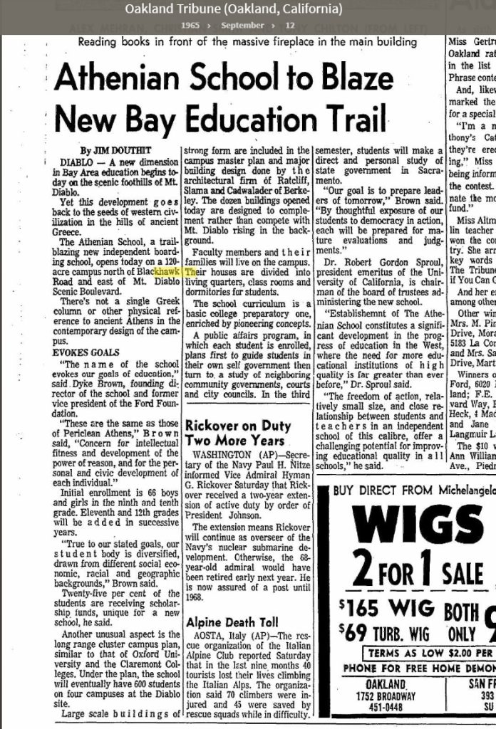
Athenian opened its doors in September 1965 with an initial enrollment of 66 students and live-in facility members and their families. Imagine the consternation on the part of an exclusive wealthy community to the intrusion from kids and families on bikes and foot, exploring these new surroundings and traipsing through Diablo streets.
Button Down Access to Diablo Streets
Of immediate attention was to close Calle Los Collados to vehicle traffic. This street was directly across from this new Athenian School Parking Lot and Diablo did not want school traffic to WAZE their way to school especially at drop off and pickup times.
One Diablo resident who grew up in Diablo said he remembers the days when this street was open and his dad would rev up the car engine and tell he and his brothers to look out for cars as he ploughed his way on the diagonal onto Mt. Diablo Scenic Blvd.
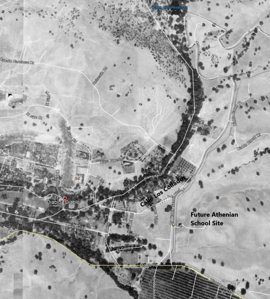
Today you can still see a number of the original Palm trees planted on both sides of this road as it joined Mt. Diablo Scenic Blvd. Note how the road comes in on an angle making a no stop signed intersection a bit sketchy. In any case, the decision was made to close this road to vehicle traffic and leave a walkway for non- vehicle use. Today this is called the Athenian connector and has a pedestrian gate across the opening. It is widely used by hikers, dog walkers, and cyclists in addition to Athenian students. A cursory view shows how this connector was part of the original public road.
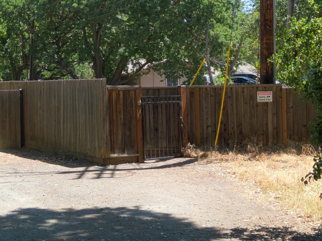
This was not the only effort to close down Diablo. Other efforts were undertaken to tighten points of access and limit connectivity between Diablo and other local streets or housing developments. There was fear and concern about security and that seemed to drive the community inward.
If Diablo residents were unnerved by Athenian students and their bike and vehicle traffic, just wait until the 1970s when development along the Green Valley Corridor exploded. Blackhawk is often blamed for the changes but Diablo itself was growing like a weed and the stage was set for the Diablo Lakes controversy.
Diablo Public Utility District New Map 1952
Diablo Public Utility District Approved 1951
Diablo Public Utility District reorganization